News
New Report From the Summit of Jebel Lawz!
Previously I shared the experience of our climb (back in 1994) to the top of Jebel Lawz, the highest peak in northwest Arabia. I also posted the wonderful report our friends shared with us of their attempt to get to the peak as well. Though they did not get to the top on that prior trip, I am thrilled to be able to share with you their recent climb where they reached the summit! We are so grateful to them for their willingness to share their experience with us and for such great information regarding their trip! Their account follows below. Enjoy!
Climbing Jebel al Lawz, Saudi Arabia, Nov 2021
My explore friend, Steve Park and I climbed Jebel al Lawz the highest mountain in the northwest of Saudi Arabia. Some people think is the famed Mount Sinai of the biblical Exodus. The very place God spoke to Moses and gave the 10 Commandments. About 2 years ago we tried to climb the mountain with the details that Jim and Penny had given us, but we ran out of daylight. They had done it as a few days backpack into the area. We were doing it as a day hike, again. Without Jim and Penny leading the way, we could not have done this. Most people that have a passion for Mount Sinai in Saudi Arabia actually think the peak Moses climbed is Jebel Maqla; a little way south of Jebel al Lawz. I believe that Jebel Maqla is the site of Mount Sinai.
Date: November 2021
Total climb time: 9.5 hours
Start time: 7 am
Start location: 28°41’5.69″N, 35°19’59.42″E
Top of Jebel al Lawz location: 28°39’14.65″N, 35°18’14.36″E
Total Distance: 8.07 miles
Total Elevation gain: 3,409 feet
Weather: clear and beautiful – perfect fall day
Water: 5 liters of water each, we drank most of that
Food: tons of snack food, plus extra
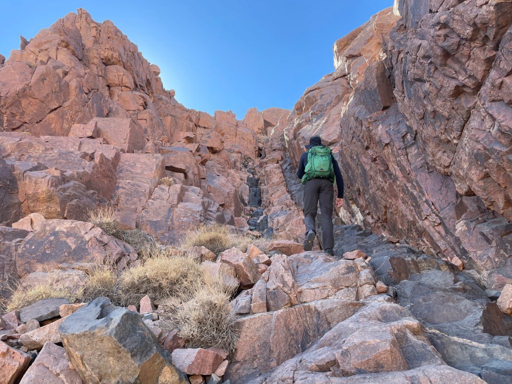
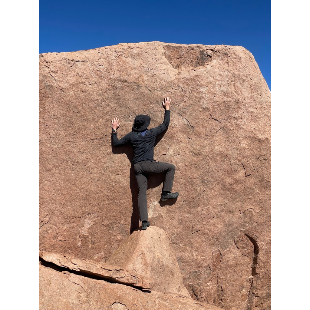
Class 2 / 3 hiking most of the way, Class 4 to get almost to the very top, Class 5 to reach the very top (we did not get there, but a few meters below)
As we started to drive into the wadi (valley) [ 28°41’3.12″N 35°24’10.90″E] where the “trailhead” of the Jebel al Lawz climb starts we realized that a new road was being built into the area. From what we understand the Saudis desire to build a ski area that would be in some of the very area we were hiking through.
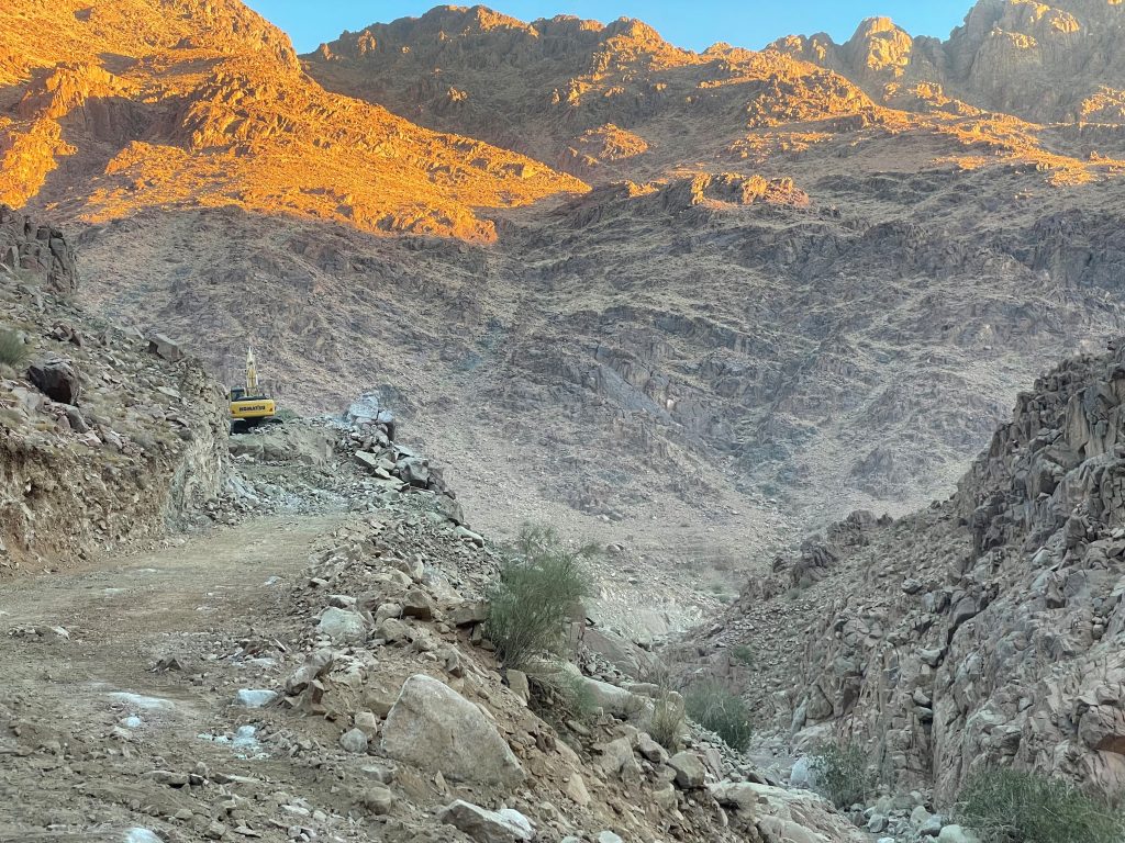
This new road helped us in two main ways, we were able to drive up the wadi father than Jim and Penny [J/P parked about 28°41’19.60″N 35°22’14.84″E] [we parked at 28°41’5.69″N , 35°19’59.42″E], and we were able to hike on a temporary road for the first number of kilometers at the start and finish of our hike. The downside is that this road [end of current road 28°40’44.94″N 35°19’14.41″E] is destroying a very beautiful wadi we hiked in just two years earlier. In the future it seems like you will be able to drive almost to a location close to where Jim and Penny call the Hidden Valley Entrance [ 28°40’27.80″N 35°18’45.45″E]. I am not sure if the ski area will go up this wadi as well, but probably. To hike the mountain in the future you will need to hike through the new ski area.
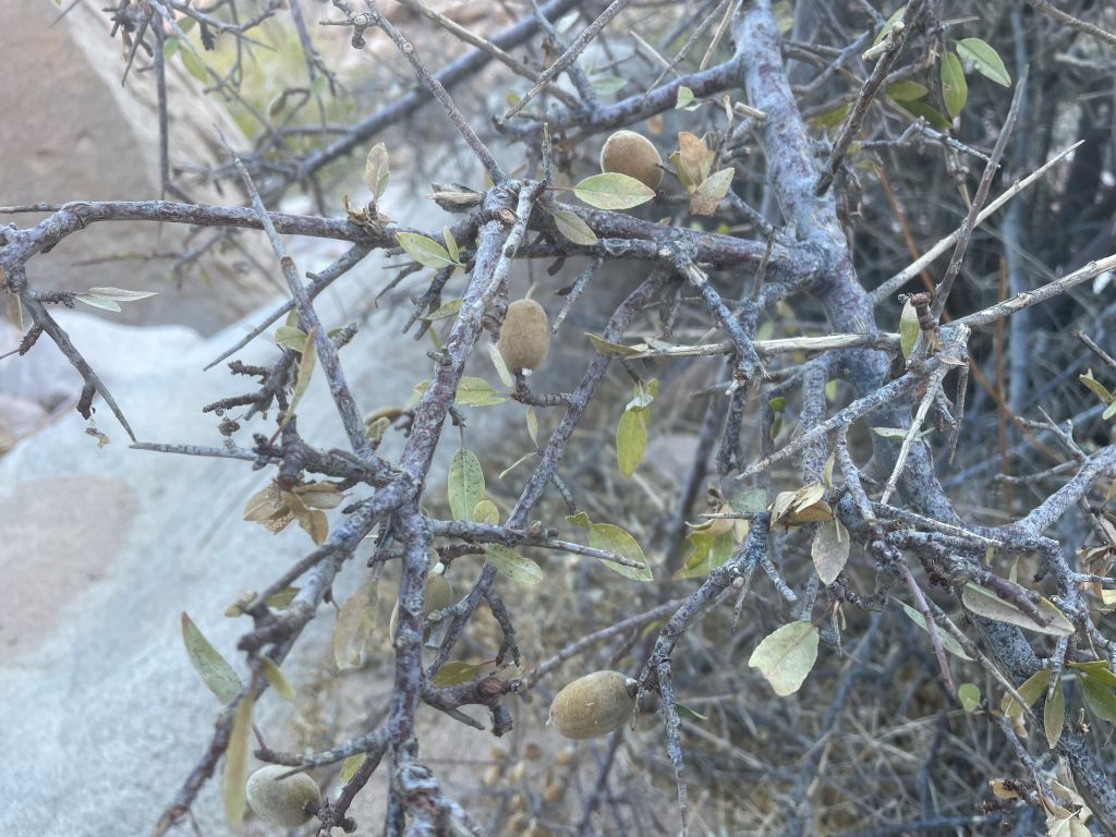
Jebel al Lawz means Almond Mountain and we did see almond trees along the way. From the Hidden Entrance we hiked up this wadi until we turned up the mountain at about 28°39’54.55″N , 35°18’40.51″E. A note on hiking along the wadis. We have learned that on the sides of the wadis there is normally some kind of shepherd’s trail. The best way to know if you are on this trail is that there is animal droppings along the way (camel and goat is what we saw). Normally these are easier to walk than the bottom of the wadi. For us it seemed like the shepherd’s trail went more on the right side of the wadi as we headed up.
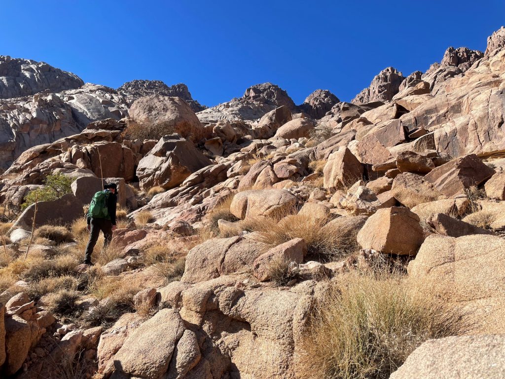
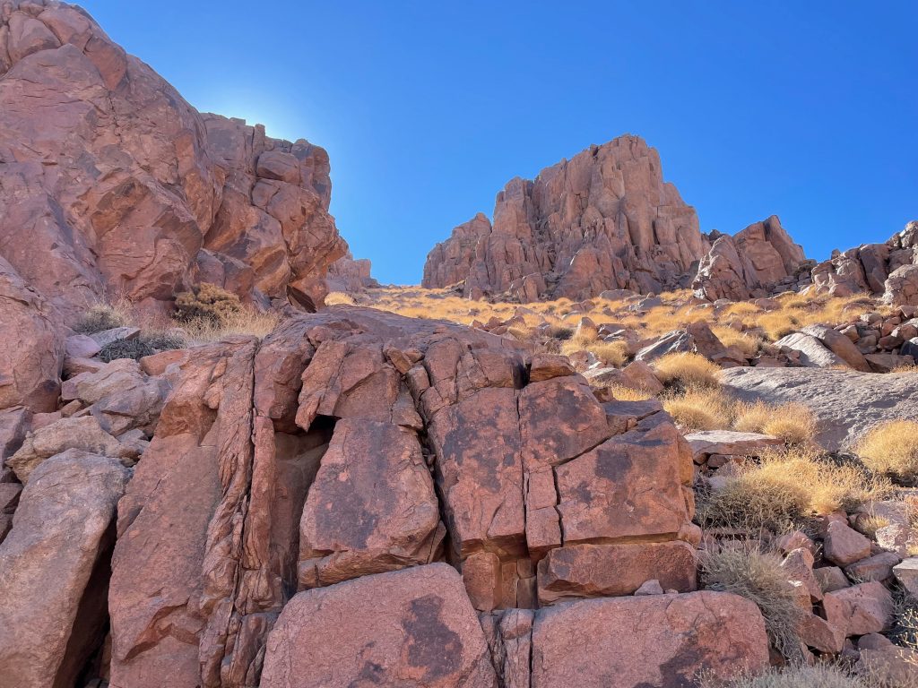
We turned up out of the wadi and most of the hiking from here would all be considered Class 3. There is no trail at this point, we just made our way up as far as we could to with a general idea of the way to go. We had a few waypoints given us by Jim and Penny that kept us going toward the right peak. As you climb up it not easy to know what peck is the tallest, Jebel al Lawz.
Here are some waypoints – from Google Earth.
28°40’30.62″N , 35°18’45.20″E Hidden Valley Entrance
28°39’54.55″N , 35°18’40.51″E where we turned out of the wadi
28°39’48.61″N , 35°18’34.35″E
28°39’41.11″N , 35°18’26.46″E
28°39’28.53″N , 35°18’21.15″E
28°39’22.79″N , 35°18’18.06″E left turn
28°39’22.68″N , 35°18’17.24″E view spot
28°39’21.07″N , 35°18’16.30″E
28°39’14.65″N , 35°18’14.36″E Top of Jebel al Lawz
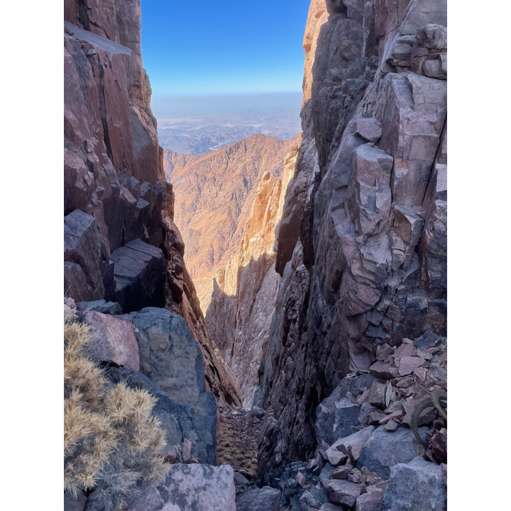
The amazing split of Jebel al Lawz is worth taking a look at [28°39’22.68″N , 35°18’17.24″E]. Then went back down and climbed up the shoot of 2 black lined rock road. Depending on the way you go from here there is a Class 3 route to the right after the black road, more direct Class 4 going more straight.
From here you just keep continue going up, Lawz will be on your right. Once here you have Class 4 climbing to get to the top.
The very top of Lawz is a little out of reach for us. We had great weather and enjoyed the top for 45 mins or so.
The way down for us was pretty much the way we went up.
On Google Maps are a few different locations of the top. This is the top: 28°39’14.65″N , 35°18’14.36″E
We enjoyed an amazing a beautiful climb,
Steven Peters